Svinkløv and Kollerup
Hiking trails, adventures and places to eat
Svinkløv Klitplantage
Svinkløv Klitplantage is an over 100-year-old and varied conifer plantation that provides good habitats for animals, birds and insects due to its dense vegetation. Wild game is common, and patient visitors have good chances of spotting red deer.
As in other Danish coniferous forests, the birdlife is dominated by species such as coral tit, great tit, goldcrest and crossbill. In the tall fir trees you may find the northern goshawk's impressive nest. Other exciting bird species include long-eared owl, red-backed shrike, green woodpecker, european nightjar and raven. In autumn, the forest can be full of woodcocks, which roost here on their migration to the south.
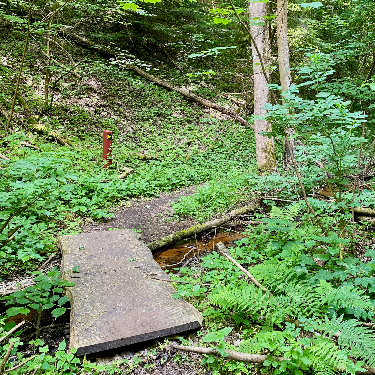
Sletteå is a natural stream that passes through the plantation without regulation, and here you can find traces of otters, just as the stream is a popular wintering place for White wagtails. Due to its steep fall, the stream almost has the character of a mountain stream.
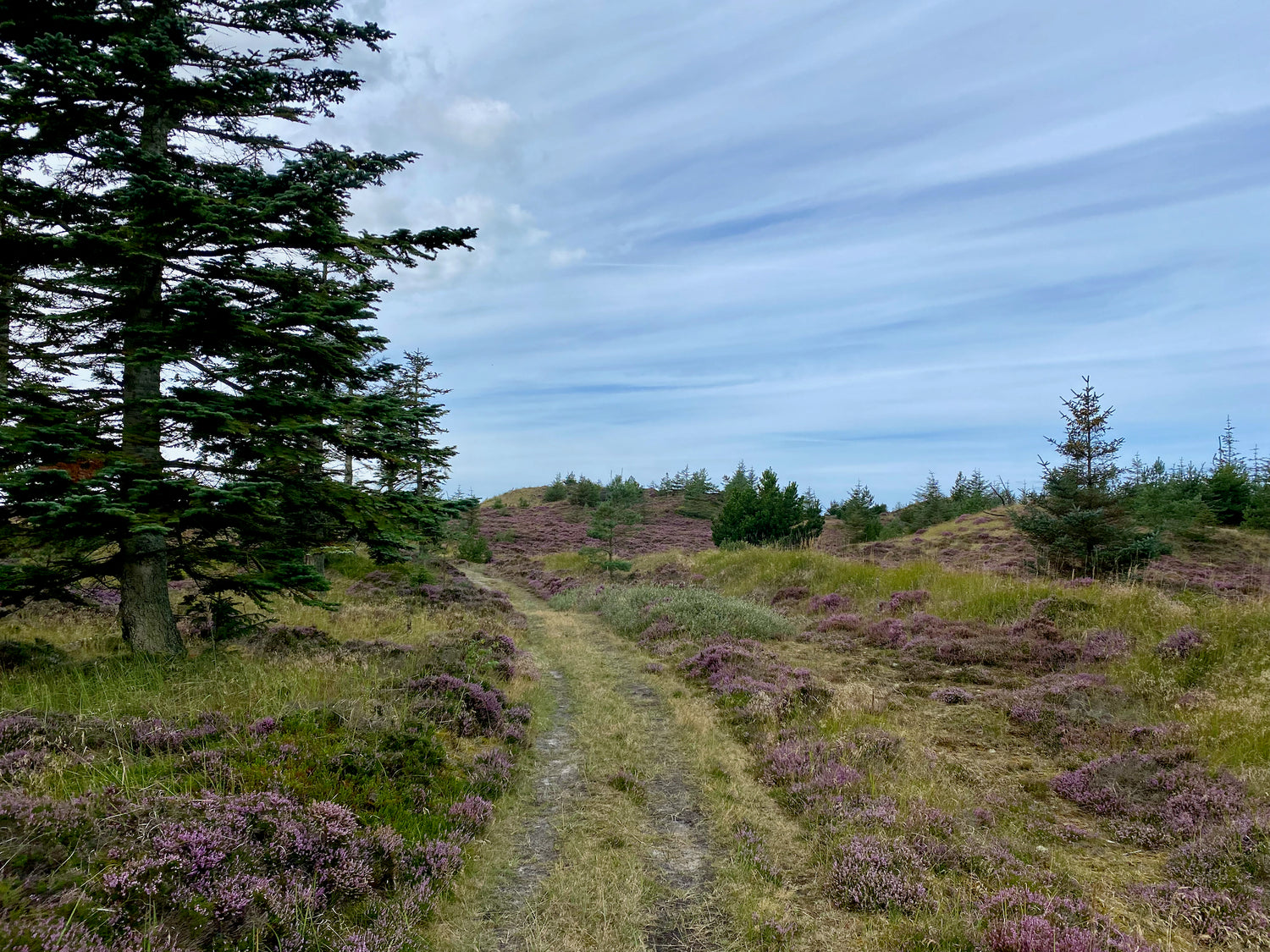
Svinklovene, which is the name of part of the dramatic landscape at Svinkløv Klitplantage, an area of 700 hectares owned by the state.
The view from the top of Svinklovene is not only beautiful, but also historically significant. Just south of the ridges lay an open strait called "Sløjen", and a channel that enabled trade fleets and Viking ships to pass between Limfjorden and the North Sea. The stretch could be monitored from Aggersborg, and it was navigable at least until the 13th century.
The entire flat area of small lakes was once a continuous sea in the Stone Age, more than 50 meters below the plantation. The water level was then about 6 meters higher than today.
Svinkløv Klitplantage has been designated as an international area worthy of conservation and is an EU habitat area.

Kollerup Klitplantage
Kollerup Plantage stretches north of Fjerritslev town, only separated from the town by a small cottage area. Despite the fact that the plantation is not directly adjacent to the city, it nevertheless functions as a kind of urban forest for the residents of Fjerritslev.
The northern part of the area consists of open heath areas. To the west and east, the plantation borders agricultural land, and to the north lies a larger privately owned area with heath and grassland, which in turn borders Svinkløv Plantage. The northwestern part of the plantation was planted considerably later than the rest of the area.
A former coastal cliff runs through the middle of Kollerup Plantage. This coastal slope formerly marked the eastern limit of a strait that connected the Limfjord and the North Sea. To the north, the coastal slope is very conspicuous in several places, while further south it is less obvious. Here, sand drift, together with planting, has helped to soften the contour of the slope.
North of the coastal slope, Kollerup Plantage was established on raised seabed, on a sandy dune plain. Even the higher areas of the plantation are affected by sand drift, however the sand layer is limited in several places and the forest is lush and rich in biodiversity. The forest forms a remarkable part of the landscape, with peaks up to 45 meters above sea level.
The northern part of Kollerup Plantage borders the Grønnestrand area, which presents large areas with blow-off surfaces, parabolic dunes and dredging lakes along the sea.
This area has experienced significant overgrowth, but thanks to targeted municipal efforts, the dune landscape has been highlighted and sustainable care with livestock has been established. At the same time, deforestation in Kollerup Plantage contributes to emphasizing the characteristic landscape.


The hiking trails
Below you see the selected hiking trails from the hiking area with mileage.
We have prioritized the trails with our favorite trail in the area as the first.
You get information about each hiking trail by clicking on the pictures.
Hjertestien 4.5 km
The hjertest (heart path) red route follows the upper edge of the coastal slope to Svinklovene and back on the flat foreland along the coast. The trip offers many beautiful views, including to Svinkløv Badehotel.


Hingelbjerge combined route 4.7 km
You hike in the protected Hingelbjerge, which offers a hilly Ice Age landscape with Han Herred's highest point, Nordbjerg, which is 83 meters above sea level, as well as many burial mounds and breathtaking views of both the Jammer Bay and the Limfjord.


Søbakke route 4.5 km
The route takes you partly on and partly along the foot of the old coastal cliff, as well as across the protected dune. As you wander south, you can see two partially preserved giant houses from the Peasant Age, which was around 3500 BC.


Faldet and Kaprifoliedalen 3.5 km
(Sankt Olavs Kilde route)
On your hike you will come across varied terrain. You come through Faldet and Kaprifoliedalen, which are lush forest gorges that are very hilly. In other places, you walk parallel to the course of the dirt road, which is more leveled and flat.


Kollerup West 4 km
On the tour around Kollerup Plantage, you will go on a pleasant tour of the plantation, where you will walk along the coastal cliff of the Stone Age sea and with the view from Toppen, as the highlight of the tour.


Ideal sequence of the trails for minimizing transportation distance
We recommend that you follow the hiking trails in the following order to minimize the distance between them:
- Hjertestien (red route) 4.5 km
- Faldet and Kaprifoliedalen 3.5 km
- Søbakke route 4.5 km
- Hingelbjerge combined route 4.7 km
- Kollerup West 4 km
You can choose to skip paths so that the distance fits what you want to walk.
For example, if you want to walk 13.7 km, you simply follow the Hjertestien, skip Faldet and Kaprifoliedalen and then follow the Søbakke route and the Hingelbjerge combination route.

Be aware:
Hjertestien and Faldet and Kaprifoliedalen can advantageously be walked consecutively. On the Hjertesti, you cross the asphalt road near the beach hotel (marked with an arrow on the map). From here, you can walk the Faldet and Kaprifoliedalen and cross back again on the way home.
The Hingelbjerge combined route can be shortened to approx. 2.5 km if you follow the yellow route all the way around and to approx. 3 km by following the red route all the way.
Experiences and sights
-

The King's Column
When King Frederik the Sixth visited Grønnestrand on 21 July 1824, he stated:
"This desolate place is the most beautiful spot in my kingdom".
In memory of this visit, the lord of Aagaard, Johan Casper de Mylius, erected this memorial, which thereby became the first building at Grønnestrand. -

The heather mill
The mill at Grønnestrand is Denmark's only remaining heather-clad mill. It is more than 100 years old.
A large part of the mill consists of oak wood. The mill's motor and wings are made of larch wood, which is light and elastic. The mill is covered with heather from the region.
The mill was protected in 1986 and restored with assistance from the National Museum in 1989. -

Svinklovene
Experience the undulating and beautiful, green landscape at Svinklovene, which forms the northwestern corner of Svinkløv Plantage.
Enjoy the breathtaking view over the countryside and Jammerbugten.
Perhaps you can recognize the landscape - this is where the nature footage for the well-known TV series, Badehotellet, was filmed. -

Jættestuerne ved Søbakke
On the heath by Søbakke you can see two giant huts from the Stone Age, around 3500 BC. However, the giant rooms are only partially preserved. They lie just above the old coastline from the Stone Age.
When you take a walk in the area, you can imagine that they were very close to the sea of the time. Later the land rose and created the flat land to the west. And later again, the violent sand drifting changed the appearance of the area.
Some believe that there may be even more remains from ancient times under the sand. -

Gallery Lien
Galleri Lien is also known as the "Louisiana of Jutland". An art center dedicated to modern art, surrounded by some of Denmark's most beautiful nature.
Galleri Lien presents extensive exhibitions all year round. The assortment ranges widely and includes both Danish and international Cobra painters, as well as a wide selection of other artists. -

Han Herred Sea Boats
Here you can follow the restoration and new construction of old sea boats from the period 1900-1960s, which are carried out by professional boat builders and associated apprentices at the shipyard.
You have the opportunity to see the exhibition about the project in the sea boat house and see the boat building at selected times.
The boats are used by the association's members for sailing, leisure and pleasure fishing, diving and teaching. The project also secures and further develops the art of boat building and the art of navigation for the benefit of the fishermen.


Restaurants and cafés
-

Svinkløv Badehotel
Local producers form the foundation for the Svinkløv Badehotel restaurant. The menus are 100% organic, where everything is made from scratch.
Here you get a taste of the season's ingredients, which have just been pulled from the ground or the sea the same morning - natural, simple and honest. -

Rønnes Hotel and Restaurant
In the restaurant at Rønnes Hotel, we do our best to create the right atmosphere, so that good food and hospitality can be enjoyed in our cozy surroundings.
Our skilled kitchen team makes delicious food from scratch in good quality and uses seasonal ingredients. With us, quality, tradition and innovation are words we attach great importance to. -

Strandhotel Klitrosen
Klitrosen is a lovely bright and inviting place where you can enjoy a delicious meal on the terrace or inside the restaurant. The hotel's new restaurant is decorated with danish designer furniture, photographic art and glass art.
The detail has been thought of for the eye and not least for the palate. The restaurant offers a high standard with only the best ingredients, which are often from the region. -

Hotel Nor - Restaurant
Hotel Nor is beautifully located in the middle of the magnificent west coast nature at the top of the Lien slope. Here you have a unique view of the North Sea and beyond Jammerbugten.
Here, the surroundings the place is a part of are used, fresh fish from Skagerak will be on the menu, among other things.


Equipment for your hike
Naturting - Fjerritslev
The uniquely harsh and raw landscapes of North Jutland, the wind, and the vast expanses can easily make us humans feel small, and in reality, it may not be harmful at all.
We all occasionally need to disconnect and find peace from a busy everyday life with fixed routines, jobs, and many tasks.
And that's exactly what nature can do. It can help us lower our shoulders, relax, and put the mind and body in neutral, all while the body is pleasantly active.
We know all this at Naturting, and we also know that the joy and experience of being in nature become much greater when you are properly dressed for it.